What Redistricting Could Mean for Beverly Hills’ Neighbors

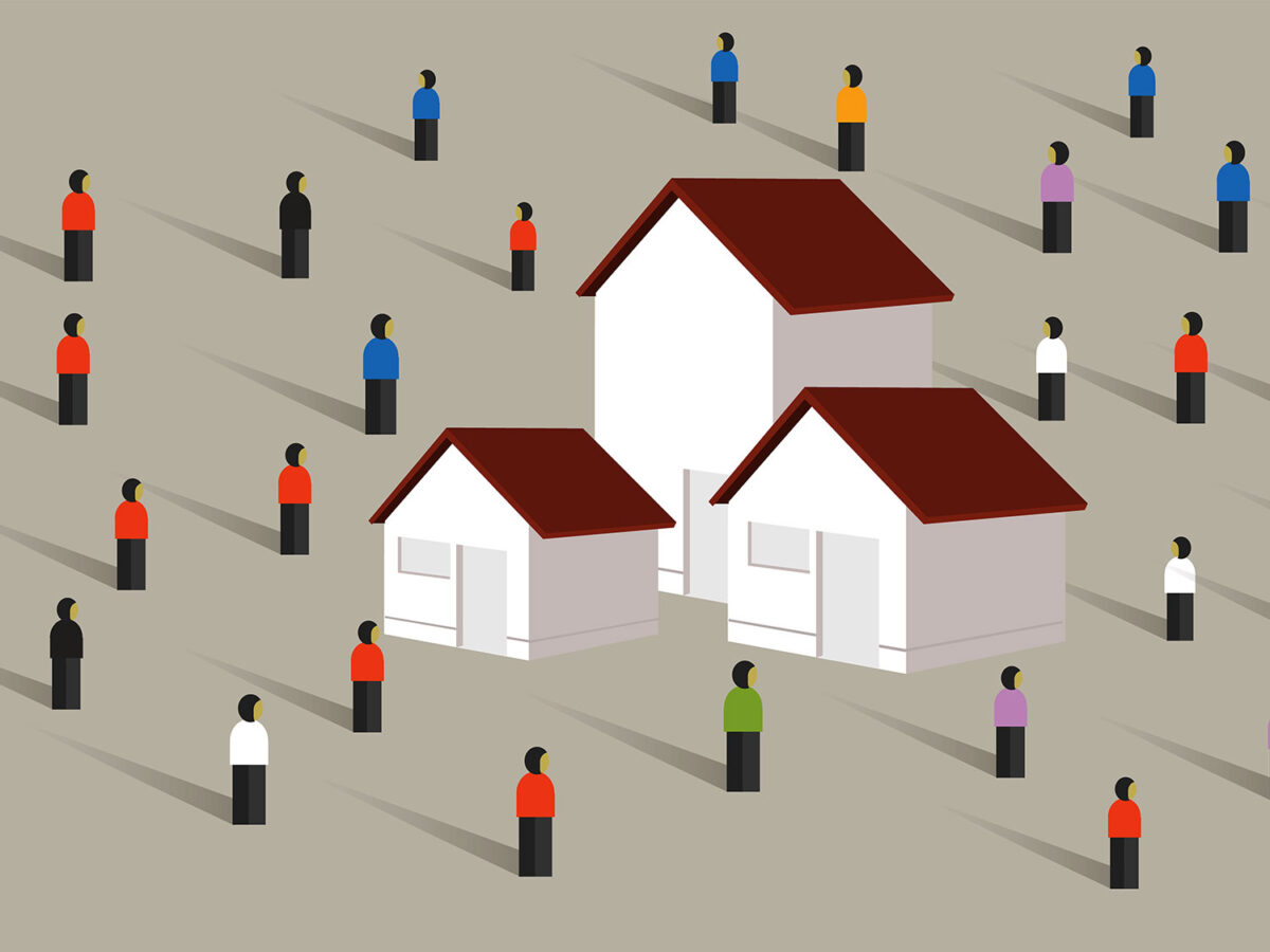
Neighborhoods surrounding Beverly Hills in the City of Los Angeles may soon see major changes in the
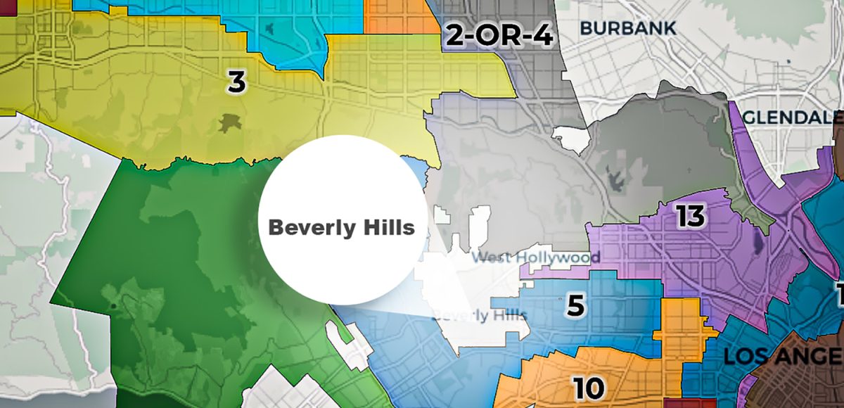
 way they are governed as Los Angeles City Council districts are now being redrawn. The Los Angeles City Council Redistricting Commission adopted a final draft of a new district map on Sept. 30 and it will be presented to City Council Oct. 28 for approval.

In particular, the “Bird Streets” neighborhood just outside the northeastern city limit of Beverly Hills would become part of a proposed district that would reach all the way to the 210 Freeway in the northern San Fernando Valley. Currently, the Birds Streets area is represented by Council District 4 which includes Los Feliz, Hollywood, Sherman Oaks, Van Nuys and more.

“I don’t think people realize how incredibly important it is,” president of Doheny Sunset Plaza Neighborhood Association Ellen Evans told the Courier about the redistricting plans. 

Evans is also a member of the Bel Air-Beverly Crest Neighborhood Council. She said she and her community are happy enough with the proposed map, but the shape and size of the proposed district for her neighborhood has raised some concerns that a council representative would have too many disparate priorities. 

“It’s a funny shape and I think you’re supposed to avoid funny shapes,” Evans said. She said her neighborhood’s biggest concern is it has already had three different council representatives in the last 10 years. This makes it difficult for neighborhoods to effectively influence district policies and programs, she added. 

There have been so many different proposed maps leading up to the final draft that L.A. neighborhood councils did not really have a chance to voice opinions to the Redistricting Commission, according to Hollywood Hills Neighborhood Council President Anastasia Mann. Neighborhood councils are bound by law to follow voting procedure before issuing such a position.

“There’s literally no way a neighborhood council can take a position on a new map every single day,” Mann told the Courier. “I hope they do things based on community interest and not political interests.”

L.A. City Council District 5 which includes Bel Air, could also see significant change. This proposed district would no longer include parts of Encino. It would also reach from the northern Bel Air border and wrap around south of Beverly Hills into Larchmont and Windsor Square areas. Larchmont and Windsor Square are currently part of Council District 4.

A narrow strip of neighborhoods near Melrose Avenue, just east of Beverly Hills, would become part of proposed District 13, which would reach through East Hollywood all the way to the Glendale city limit.

In addition to redrawing boundary lines, the commission is also considering renumbering Council District 4 and Council District 2. This would amount to a label swap between neighborhoods in the heart of the San Fernando Valley and neighborhoods from Hollywood Hills through the east Valley. The redistricting commission has left it to the L.A. City Council to number the two districts in question. 

L.A. Councilmember Nithya Raman who currently represents District 4 and Councilmember Paul Krekorian who represents District 2 have both spoken out against the map, as they would be representing residents who did not vote for them if the plans are approved.

“The proposed draft map effectively completely erases District 4 as we know it, leaving a district with either zero percent of our current residents or 29% of our current residents, at a time when the minimal increases in census population in Los Angeles shows no basis for such drastic shifts,” said Raman in a statement. “Coming on the heels of an election with historic voter turnout, how can we in good faith encourage people to participate in municipal politics only to wholly discard their votes?”

The total population of Los Angeles only increased 2.8% from 2010 to 2020, according to U.S. Census data. Comparatively, New York’s population grew 7.7% in the same decade.

“The Commission was supposed to protect fair and equitable participation by the voters of Los Angeles in selecting their representatives,” said Krekorian in a statement. “It would completely reverse the results of elections that took place just last year. It would disempower voters of Armenian, Korean and other ethnic backgrounds. And it would silence the public by limiting comments to only one possible set of maps – in direct contravention of the commission’s own outreach plan.”

Despite council members’ protests, L.A. city staff told the Courier the commission’s goal from the beginning of the process was to narrow all possible maps down to one which they would present to the City Council. There have been multiple public outreach meetings hosted virtually by the commission since July and ongoing opportunities for the public to submit their suggestions for the map.

Typically, this public outreach process would have been more robust, but since the U.S. Census faced delays due to COVID-19, the City of Los Angeles only received the population data a month ago, L.A. city staff told the Courier. This data largely determines how the districts are mapped.

With three public hearings remaining in October before the map goes to L.A. City Council, staff said that residents still have time to influence how the final district boundaries are drawn. On top of that, the City Council will have an opportunity to reject the commission’s map and create their own.

“We still have a ways to go,” said Rafael González, director of community outreach and engagement for the redistricting commission. “In no way does this mean it will be the final map.”

Redistricting happens every 10 years and is triggered by the U.S. Census, which is also on a 10-year cycle. The commission used 2020 U.S. Census data to ensure each district has about 260,000 residents.

“We consider this the people’s map,” Gonzáles said. 

Share Post